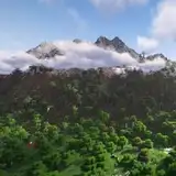
Geotiff and Worldpainter data - Central Europe [38000x26000] - 50m resolution
Added 2024-02-09 01:29:46 +0000 UTCUpdate V2 - 2024/02/12
Better coastal regions, expecially over The Netherlands
Added rivers and lakes made by real world Corine land cover data, this is the very first time I import real land cover datasets in the maps
Better clay/sand layer made by real world Corine land cover data
Caves do not break the surface anymore, and they are now reduced in number
Thank you for subscribing Top Tier membership!
Here come the details of the data used to make Central Europe Map at 50m resolution [38000x26000] (Minecraft World Maps - Central Europe [38000x26000] - 50m resolution | Patreon):
Biomes map

DEM data

Data used:
SRTM V3 30m resolution DEM data - cubic reinterpolation to 50m
Gebco 15arcsec resolution Bathymetry data - cubic reinterpolation to 50m
Corine Land Cover 100m resolution data for coasts, sand/clay, rivers and lakes masks, cubic/max reinterpolated to 50m
Downloads:
WorldPainter .world file at 50m resolution [38001x26001] [608mb]:
https://drive.google.com/file/d/10Uq5ejyrImMN9ErT6VLM69afYL-qkOZI/view?usp=sharing
Merged DEM & Bathymetry data in Geotiff format at 50m resolution [38001x26001] [902mb]:
https://drive.google.com/file/d/18faO_FeXpRMq8makyyRF024q7vv72aw9/view?usp=sharing