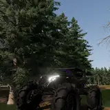
Chasing tornadoes in Colorado is weird, and I haven't exactly been lucky there. Typically each year I'll chase 5 or 6 decent CO set-ups and then skip a mediocre day or two. Those are the days CO goes bananas with photogenic tornadoes.
FOR MY NEXT VIDEO we're gonna dig into what makes CO hard to forecast 24-36 hours out. The challenge for this video will be simplifying the physics without butchering them... Lee cyclogenesis, the DCVZ, uplift regime, the lower dews, the crappy roads, and the "highway of disappointment" (that's what I call the painful drive up highway 83).
PLANNING TO DO SOMETHING DIFFERENT THIS ROUND. A CO tornado chasing video without the EPIC Simla mesocyclone ain't gonna cut it, so we're gonna use Patreon money to try and license some Simla video and perhaps some Campo video from other chasers. This supplementing my Wray & Eckley CO tornadoes plus this year's dusty landspouts should make a goodie.
ANYBODY HERE HAVE SIMLA OR CAMPO VIDEO???
I've already put a good week into this but it will likely take another or two. Hopefully when it's completed you guys will have a much deserved epic tornado video.
Jungle Jay Adventures
2018-09-25 20:50:37 +0000 UTCPecos Hank
2018-09-22 23:32:26 +0000 UTC